


PLANNERS REPORT DAY 1
Unseasonal heavy snowfall in late November seriously disrupted the planning for this years event. My first day out was Dec 30th immediately after a big thaw. It was a day of thick clag, heavy drizzle, soggy snow patches, still frozen lochs and constant paddling underfoot. A great start for openers!! By contrast a few days later on Jan 2nd everything above 400m was frozen solid again and it was out with the mettle spike and hammer for making holes for the stakes, but at least I could see where the controls were going.
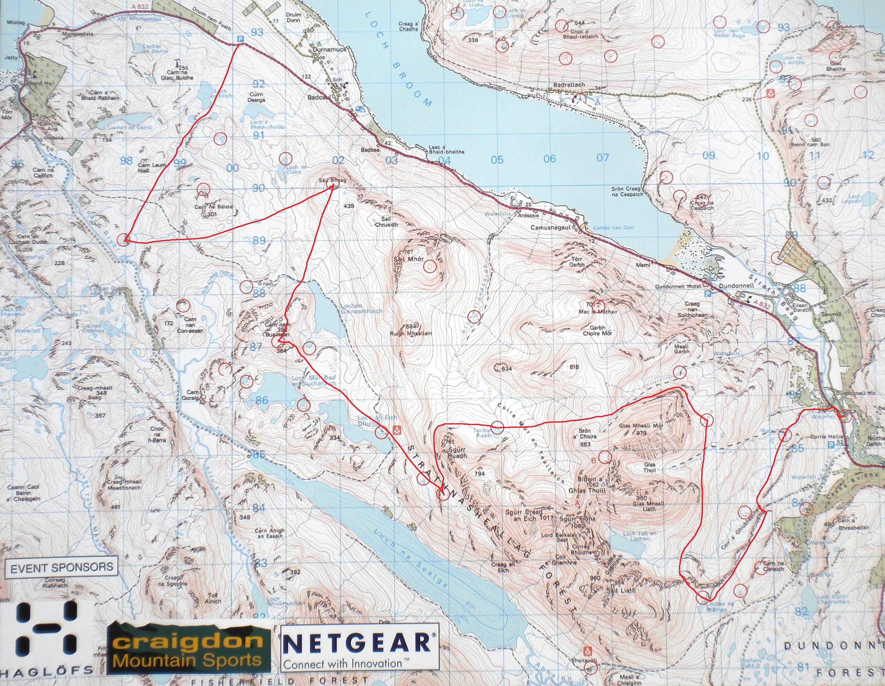
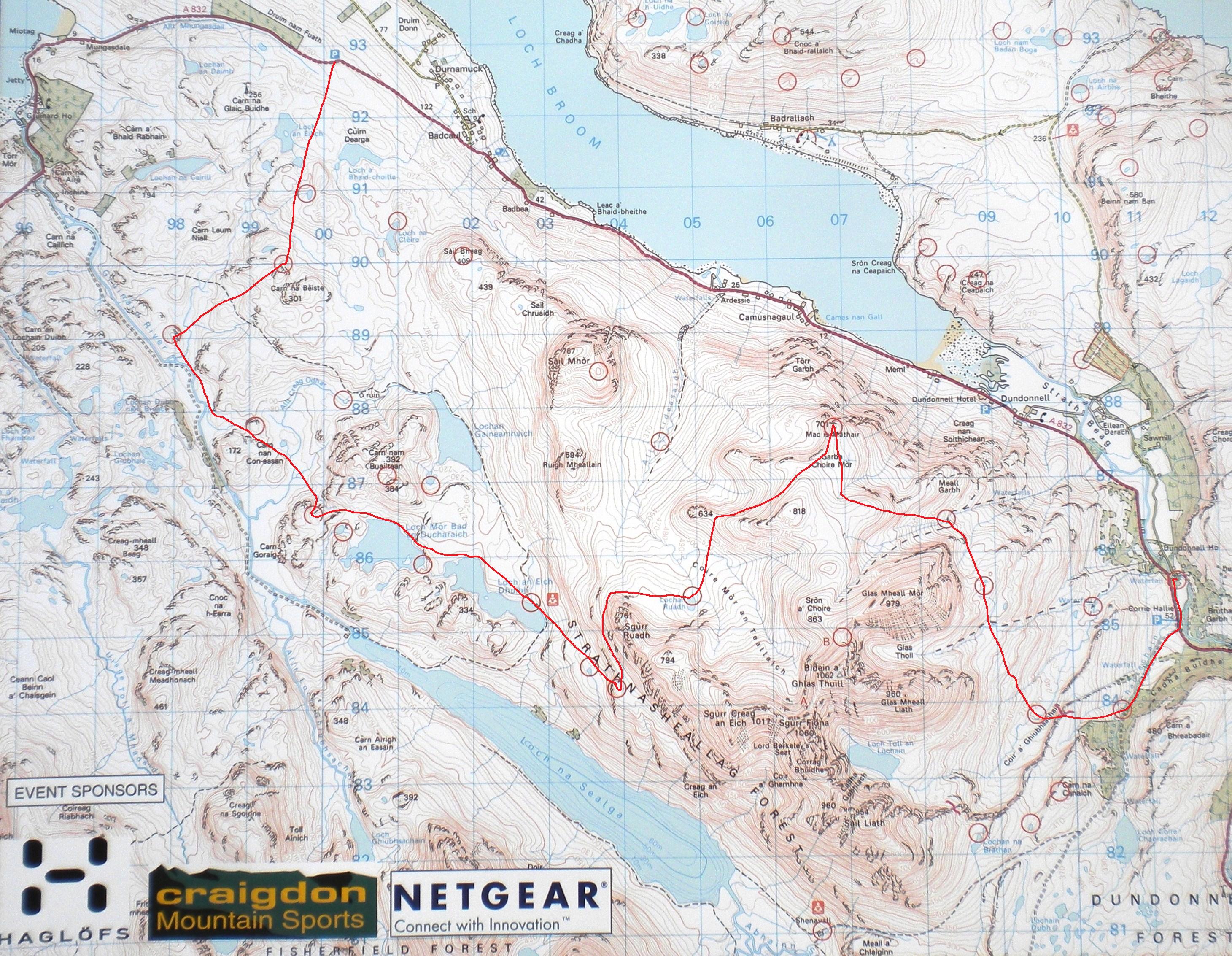
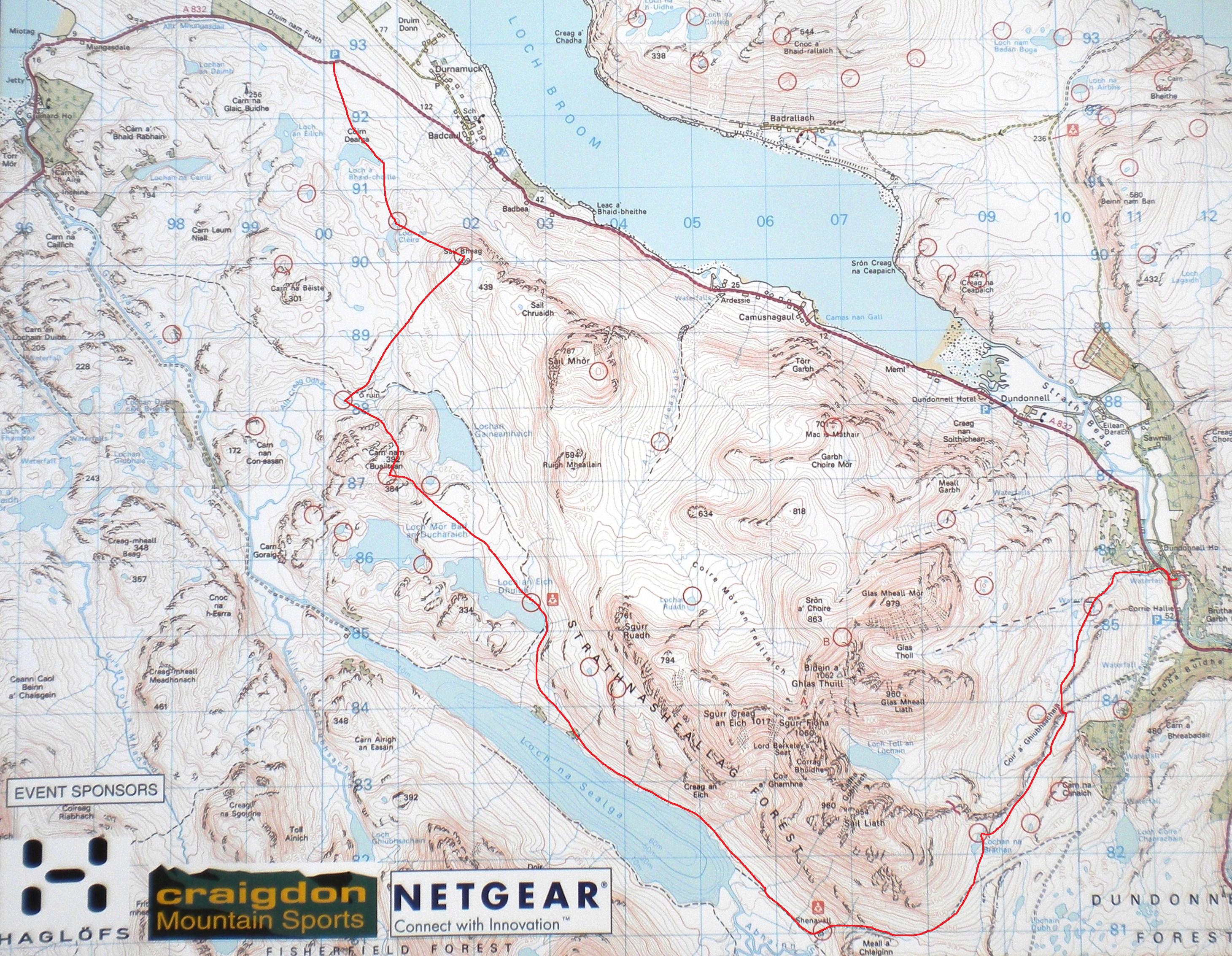
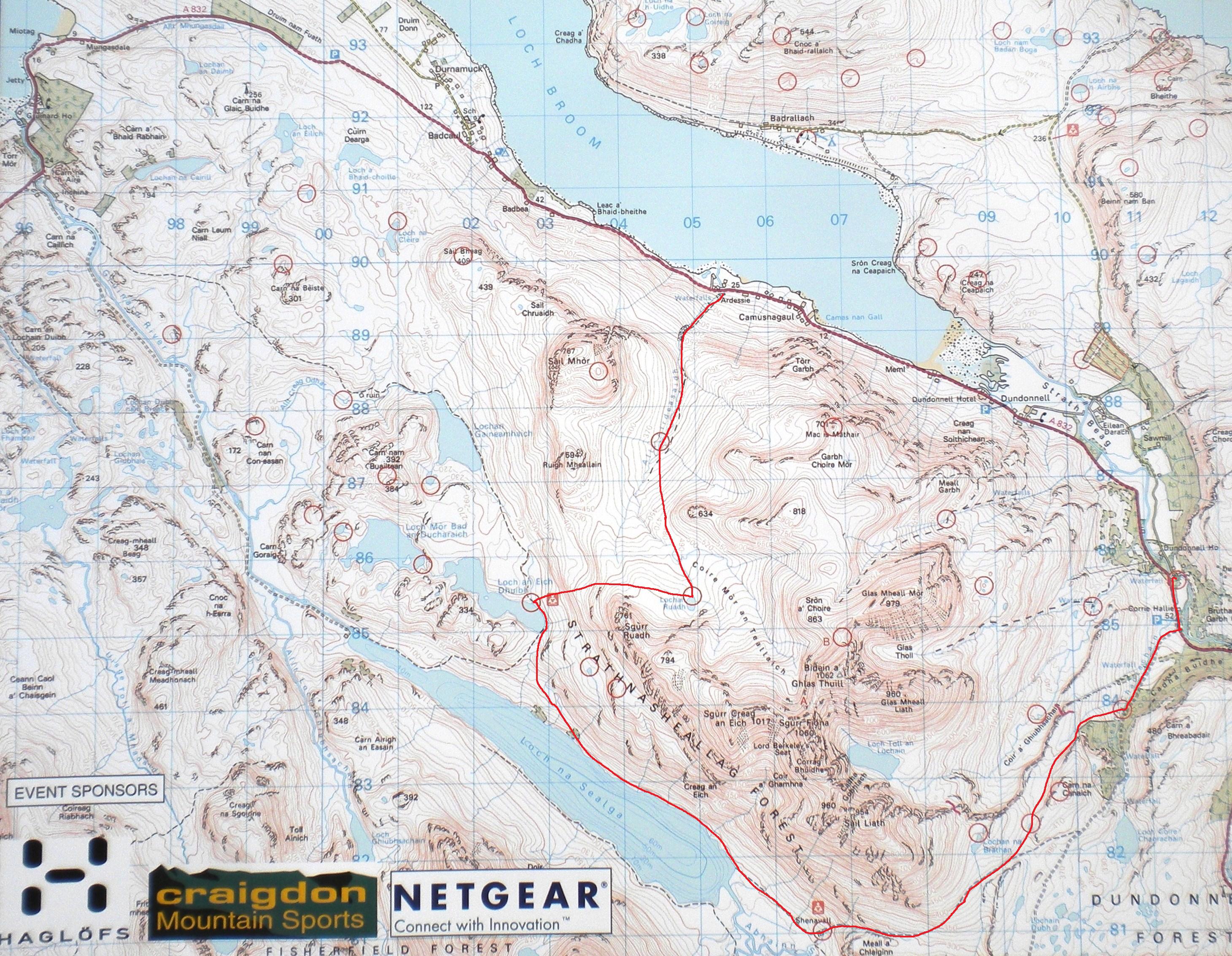
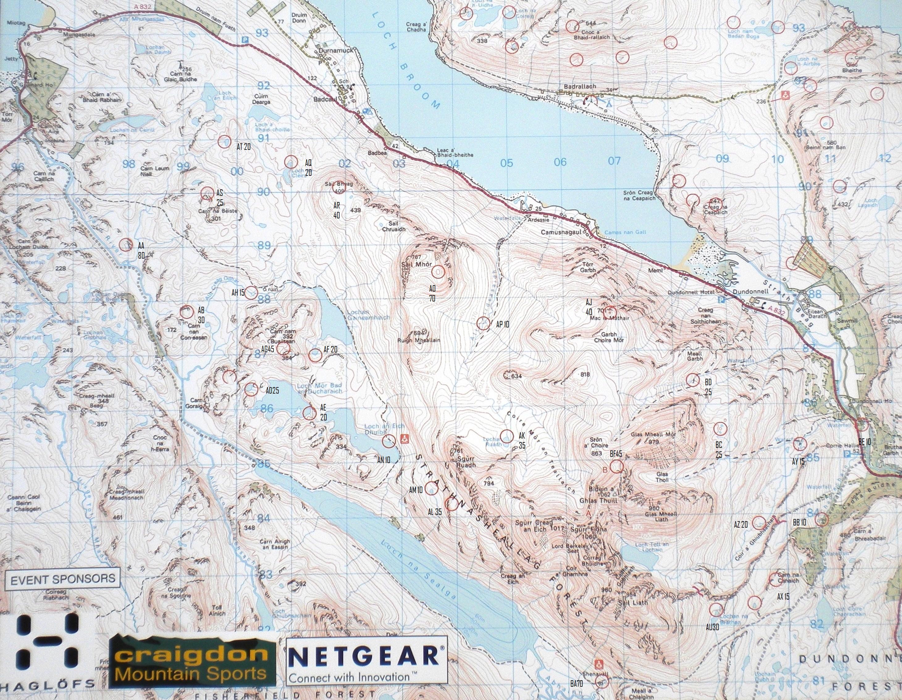
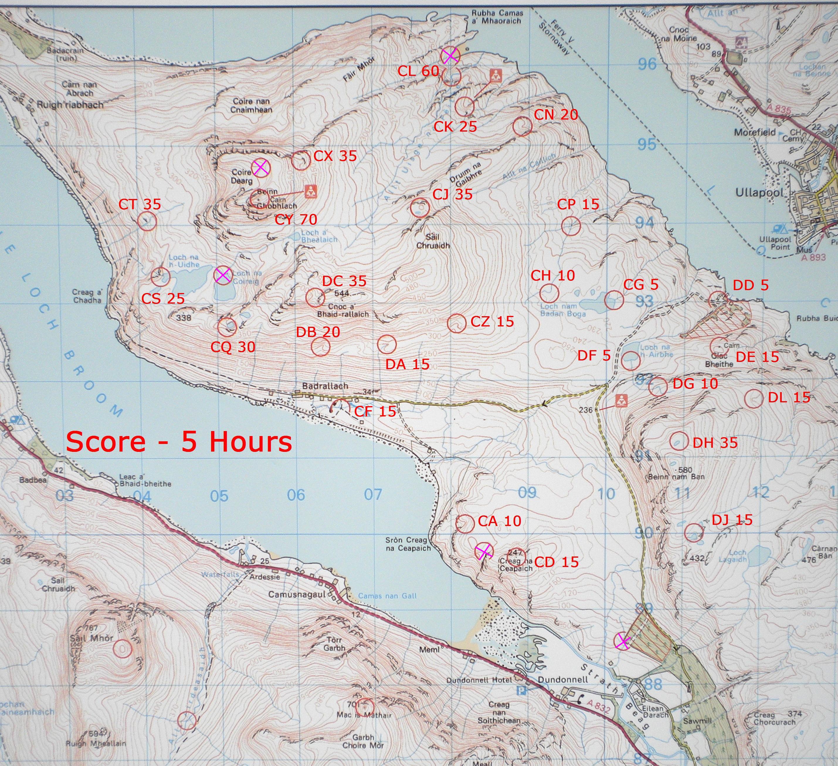
From a planning point of view the area was a dream. Beautiful scenery, masses of potential control sites, the huge bulk of An Teallach providing big route choice dilemmas, what more could a planner ask for? The score provided us with a few problems as the distance from the start to mid camp was going to make it very tight for the slower runners. I think the increased hours and an easier start for those wanting an easier day worked ok. However one crack team decided to start at Ardessie, picked up every control on the periphery of the course in just under 7 hours and covered 38km in the process, what a sterling effort, I certainly hadn’t anticipated anyone trying that.
Although An Teallach provided the opportunity for route choice problems it was also potentially an uncrossable barrier given the time of year. The early snow made it impractical to assess the two high cols once they were snow covered. As it turned out the col at A should have had a big red cross on it, but we had no way of knowing this in advance and we didn’t want to rule it out if it was ok. I think our instructions for the cols on the day worked ok though one team who ended up at A made a quick exit and traversed round to the col at B
Apart from being called a sadist, I think from your many favourable comments you all enjoyed the courses. It would be difficult to find a more scenic area in which to hold a mountain marathon and its just a pity a few more didn’t enter to savour the scenery and our continuing good fortune with the weather.
Raymond Wilby
Day 2
Planners Report
Compared with the “majesty” of Day 1 ------ Day 2 area initially seemed patchy and small with not many good map features for control sites. By adding/deleting detail and changing/enhancing contours, Miles Davis (our new map man) used his expertise to transform very ordinary OS 50k into your clear, precise event map which in turn, enabled you to unlock the areas’ hidden gems.
As to the courses – Judging by the finish times, everyone got a good skelp around the same hillside relative to their ability.
I managed to get almost everybody to the very best parts that I could find, ensuring all
competitors had good vantage points for the fantastic “all round” views.
At the finish, there were lots of comments (mainly favourable superlatives), and no one questioned my parentage ------- but I think that the good weather had something to do with that.
Dundonnell 2011– Controller’s report by Alec
This year’s event produced its own crop of challenges.
The main self-imposed one was to sort out the logistics of stringing together two good hill areas of the right proportions and linking these with a suitable overnight location and an event centre. We always felt that the Dundonnell hills would offer us the potential for a Highlander. The fact that the event actually happened is mainly testament to Alasdair’s resigned acceptance of our increasingly outrageous (and expensive) transportational requirements. He did suffer a minor sense of humour crisis when the word “boat” was first mentioned but he bore with us gamely, and we hope everyone had as much fun participating this weekend as we did in dreaming it all up.
The two days were hugely different.
Day 1 was a day dominated by An Teallach, and while none of the
courses topped out on it, everyone passed over or round it and will have
got a pretty good look into some of its remoter corners.
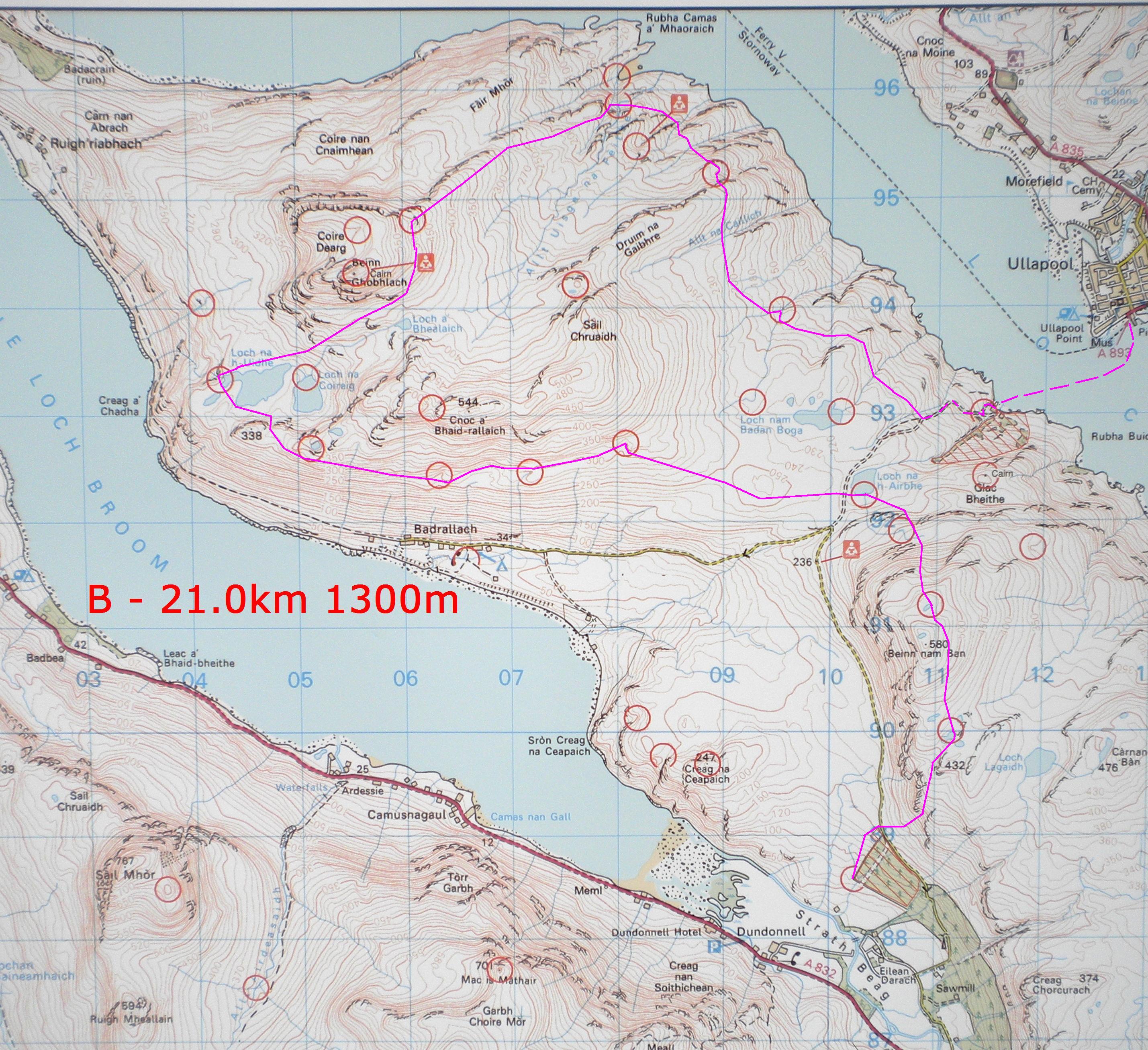
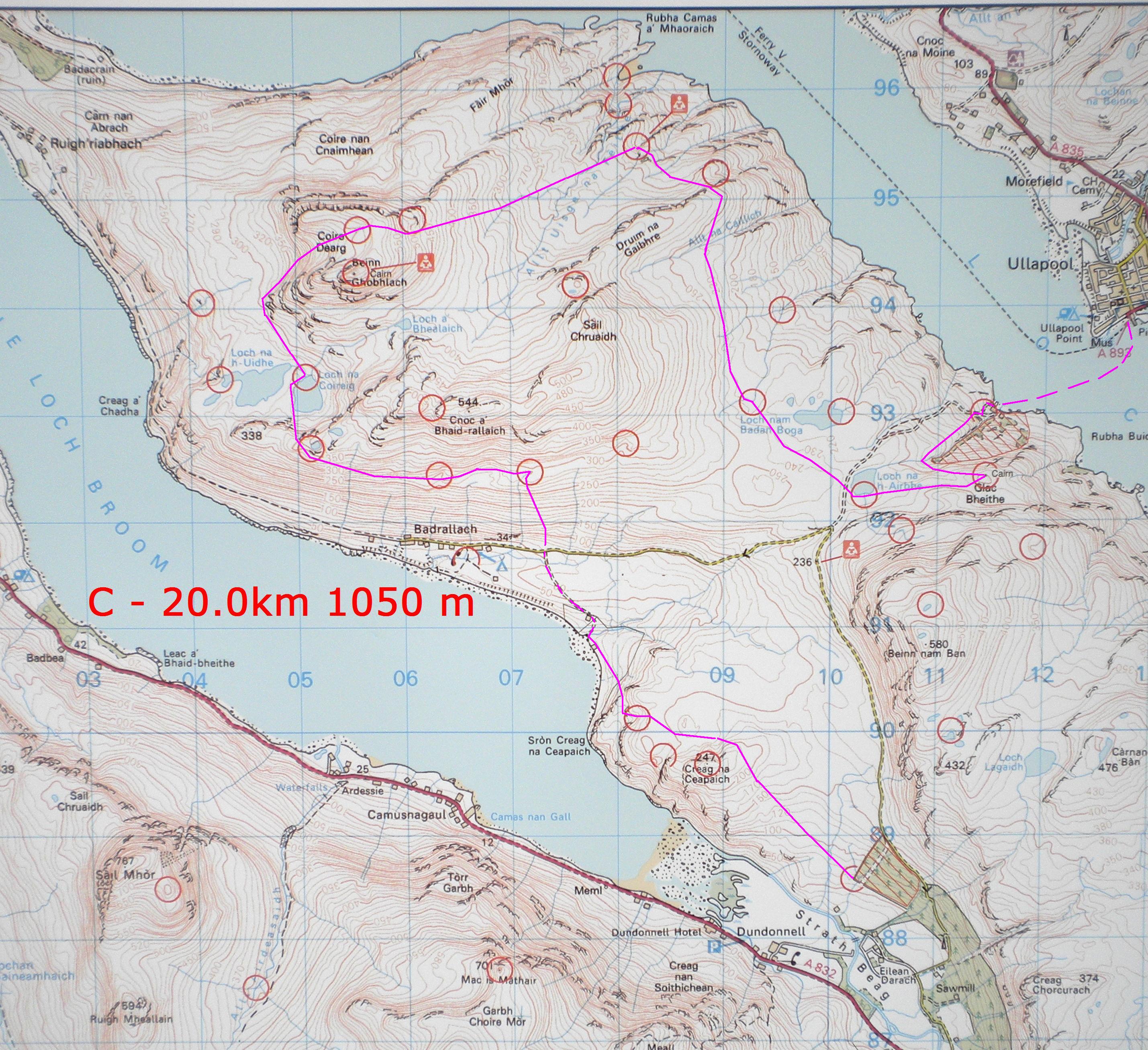
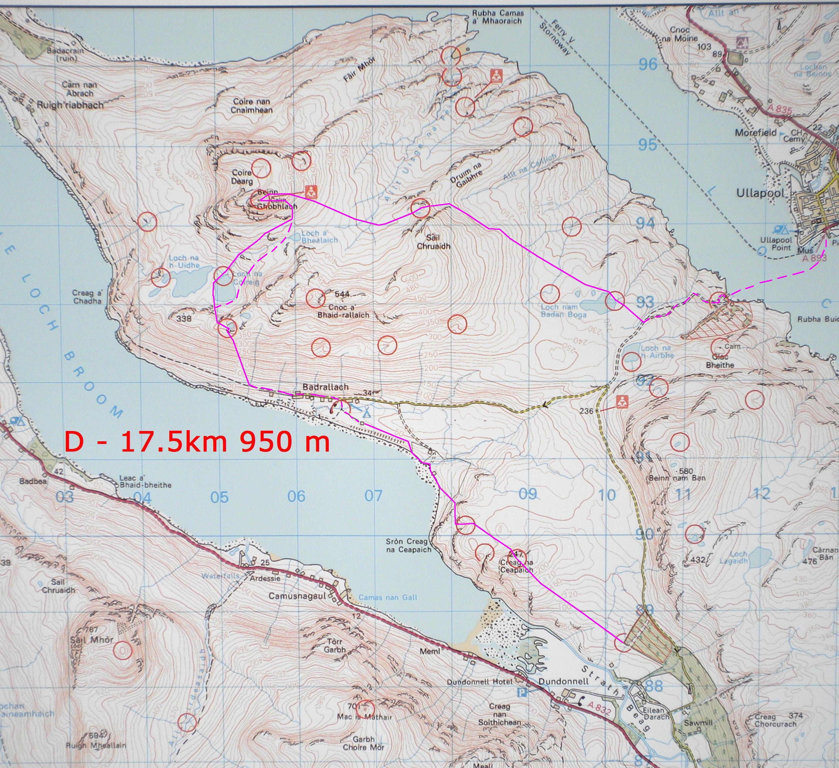
Due to the elongated shape of the day and the lack of features
near the main start, we had to manufacture an extra start to accommodate
the requirements of the D course.
Ardessie was an unsatisfactory location for this due to the grind
to get up to the hills, but was the best we could do.
It also allowed us to offer the Score an unusual pre-start choice
which seems to have generally balanced out the possibility that the
increased 7 hour time limit might have been overly taxing for some of
the class.
The Day 1 controls were pretty much all big solid features, and easy to find. Our main uncertainty was the cross-ability of An Teallach’s two high bealachs in the aftermath of the winter’s heavy snow, something which remained unknown until about 48 hours before the event. As it turned out, bealach A was out of the question – no snow, but a rugged grass slope above concealed scrag at the sort of angle that was not appropriate for being put forward as part of an organised race due to its high Death Potential. Fortunately bealach B came with a lower DP rating, and its snow wreath was avoidable with some tiger taping. We were impressed that the A class winners found it within themselves to visit (and draw back from the brink of) bealach A in mistake for bealach B, which proves that not only can we all get it wrong sometimes, but that the best sometimes also make the biggest errors.
The overnight camp location was superb, a beautifully drained field overlooked by An Teallach, and our usual array of distractions seemed to be very popular!.
Day 2 also exercised our minds, particularly when Alasdair announced last month that the rib-man had said that the rib would be fine in up to “about Force 6 or 7”. This struck us as having a bum-squeakingly low disaster tolerance, and gave rise to a whole new level of scenario planning. In the end a fantastic “menu” was concocted for you – the “cordon bleu” courses incorporated selections for good weather and sub-Force 6 or 7 bad weather; and then there were the “curry” options – the “korma course” for a day of unpleasantly high wind but otherwise not too bad, and the “vindaloo course” for when the bottom fell out of the event completely. We are glad not to have had to subject you to the latter.
The nature of the Day 2 terrain meant that a number of the controls were far more technical, and there would have been some serious navigational challenges if the cloud had been down. But you’re all up for that, aren’t you? I visited CM in the north-east “land that time forgot” corner on 2 occasions, finding an area of intensely overgrown heather on high-angled soft peat, brooding cliffs and a sense that there was probably a pterodactyl or two eyeing me up for dinner, and each time I blew up coming back out from there. There were one or two teams who did have difficulties with CT and with CS, although the majority found them OK. By the time a control box comes back in, the location has been visited by us no less than 4 times, and the grid reference checked on the ground by a GPS; our takers-in found the boxes in the right place still, and so we can only say that the controls were in the right places. However the OS map has its limitations in view of its scale, its level of detail, the features which it leaves unmapped, and its errors. We do try to correct these when we see changes which we can make to better record the features on the ground in the vicinity of a control, but we can’t cater for all its deficiencies.
And well done to all of you for your efforts over the weekend, and especially for finishing so promptly on Sunday. Much to our surprise, no-one managed to miss the boat. And once again we were blessed with extremely favourable weather. We do hope to be able to offer you more of the same next year, somewhere in the Highlands - please bring your friends with you! And remember – there can be only one.


